Services
Industries

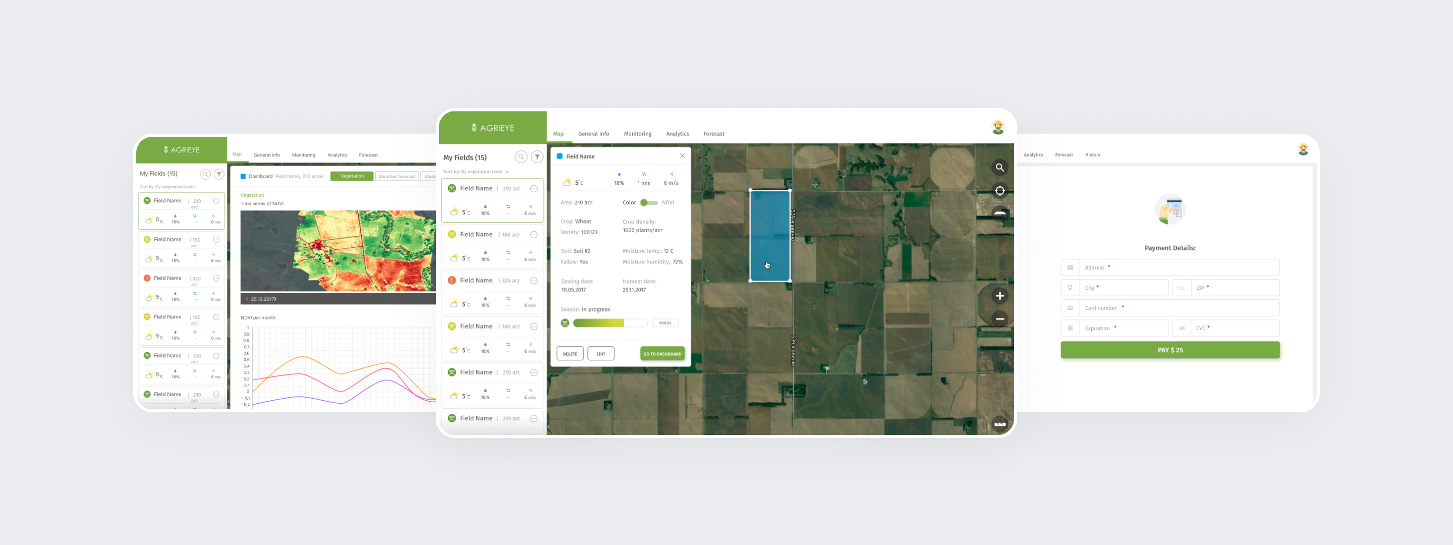
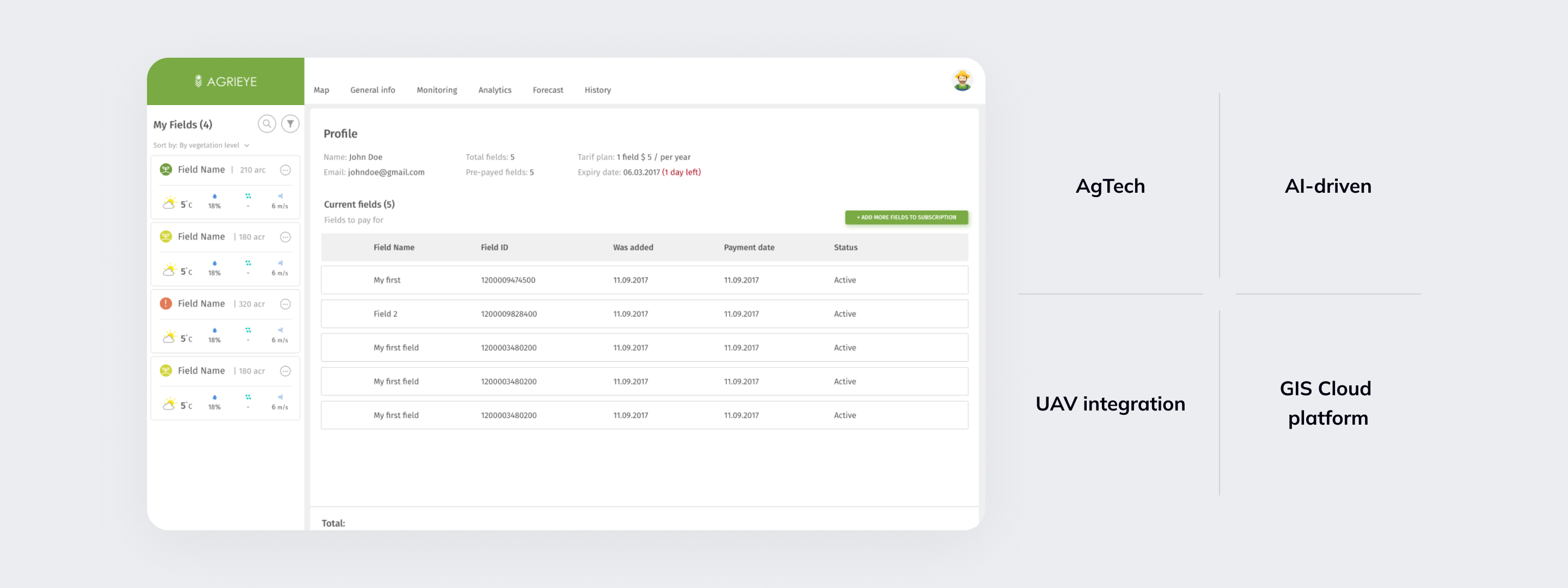
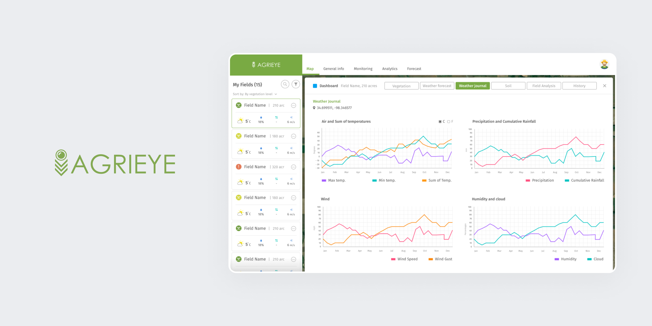
Agriculture Platform Development for Agrieye

A platform that helps farmers get a bigger crop at a lower cost providing clear guidance on the number of seeds, fertilizer, and water needed for optimal plant growth at every point in the field.

image_main
Client Agrieye
Services Software UI/UX Design
Technologies Angular .Net
Project Description

AI and Machine Learning for precision farming

Agrieye is a subscription web service. People sign up and get a free AI-based drone that scans the field. The service collects the data, analyzes and receives the results. There are recommendations and forecasts regarding the best place for fertilizing as well as predictions about the future yield. The service works with the help of Machine Learning.

The main goal is to increase the effectiveness of farming as well as provide data to investors who can invest in farm development. Having all this data, Agrieye can see the whole picture of agriculture worldwide and suggest the best planting, nutrition, and crop protection solution at any point on Earth.

project_image_full
Target Audience

Agrieye helps farmers feed the world

  • Landfarming business
    Agrieye provides an opportunity to invest in farmers by showing the transparency of their business, taking risks, productivity, and other indicators visible. As a result, a potential investor will be able to invest in farms easily and quickly.
  • Government
    While the population is growing, we need to produce more and more food. At the same time, the sown area is only decreasing. Agrieye will allow farmers to increase the efficiency of agriculture at an average of 30-40%.

project_image_full
Smart landfarming solution

Smart landfarming solution

  • Multispectral Camera. Every UAV is equipped with a special camera with high resolution to get the proper measurements.
  • UAV. Agrieye uses special drones for scanning the fields. Its platform can monitor up to 2000 hectares per day with a ground resolution of 5 cm per pixel.
  • Agrochemistry. There is always something you never know using the multispectral camera. A combination of Soil compound data together with remote sensing gives outstanding results of what exactly is going on in the field.
  • GIS Cloud Platform. For accessing the cloud-based platform users don’t need any special software, just a browser.
Design and Branding

Simple design for the complex solution

While creating the design for the Agrieye product, we were eager to deliver the most understandable and simple-to-use solution for such a complex functionality. User research showed us that the main target audience – US farmers – are not very comfortable with technologies, yet they rely on our digital solution and the new abilities that it gives.

We managed to create an easy-to-use design that reflects all the functionality of the service. We have also provided Agrieye with total rebranding and created a new design language for the brand along with all the necessary corporate and marketing materials.

Achievements

Best Ukrainian startup

Recognized as one of the best Ukrainian startups of 2017

Participant of the CES 2018 (Consumer Electronics Show)

Participated in multiple startup accelerators in New York and Oslo